
Mapping Invasive Species Across Greater Manchester’s Waterways
JKWA is developing a water-based survey, mapping and management programme to build an up-to-date picture of invasive non-native species across Greater Manchester’s canals and rivers.
Greater Manchester is the pilot. Our ambition is to develop a model that can ultimately be rolled out across the UK.
You Can’t Manage What You Don’t Know Is There
Invasive non-native plants do not respect property boundaries. Along rivers and canals they can spread between landholdings, along embankments, through development sites and downstream through connected watercourses.
Some infestations are clearly visible from towpaths and roads. Others occur on inaccessible banks, behind industrial sites, underneath bridges, alongside infrastructure or on the opposite side of waterways where conventional land-based inspection can be difficult.
JKWA is developing a different approach.
We intend to survey the waterway from the water.
Two-bank visual survey · GPS/GIS recording · geo-tagged photography
Building On Existing Greater Manchester Intelligence
Greater Manchester already has important invasive-species survey information. Previous work commissioned through GMCA’s Natural Course programme surveyed the River Irwell catchment in 2022 and River Tame catchment in 2023, creating a catchment-level picture of Japanese Knotweed, Giant Hogweed and Himalayan Balsam.
The Irwell work alone recorded 2,080 Japanese Knotweed stands, covering more than 105 km of riverbank length, from 872 km of surveyed riverbank.
0
Japanese Knotweed stands recorded
0+ KM
Recorded linear extent of Japanese Knotweed
0 KM
Riverbank surveyed
Our objective is not to unnecessarily duplicate good work that has already been undertaken.
JKWA wants to build upon existing intelligence by helping to update, verify and extend the available picture, particularly from the water, and connect current infestation information with ownership, responsibility, risk, treatment and long-term monitoring.
Meet Hind Sight
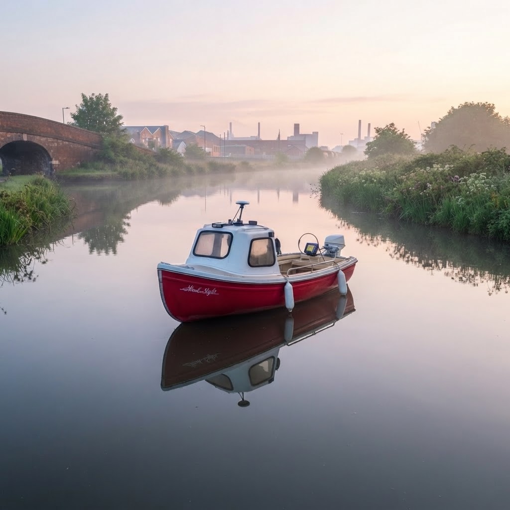
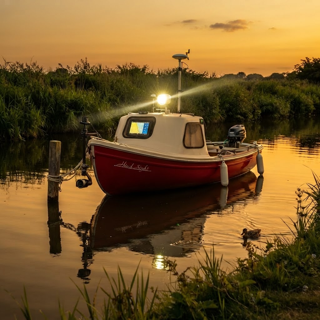
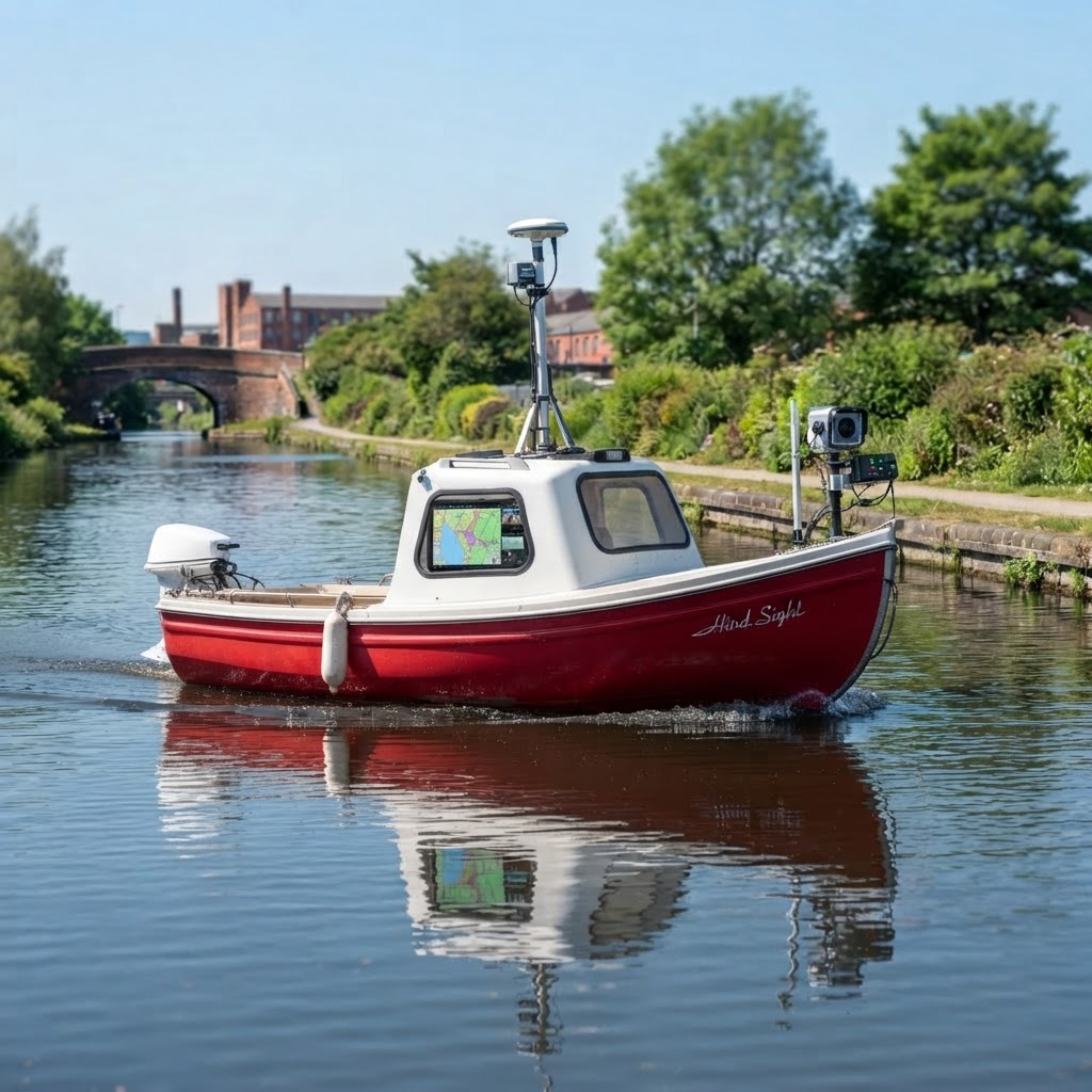
Hind Sight is JKWA’s dedicated small waterway survey vessel. Its size and mobility make it suitable for surveying sections of canals and navigable waterways where observing both banks directly from the water can provide information that conventional surveys may miss.
A small boat with a much bigger job.
How The Project Works
SURVEY
Boat, land and where appropriate drone-assisted inspection.
IDENTIFY
Identify and verify invasive non-native species.
RECORD
GPS location, photographs, extent, density and condition.
MAP
Build the information into a GIS-based waterway atlas.
OWNERSHIP
Investigate landownership, riparian interests and management responsibilities.
PRIORITISE
Assess spread, environmental impact, public safety and reinfestation risk.
MANAGE
Develop appropriate treatment or remediation strategies.
MONITOR
Return, reassess and record changes over time.
SURVEY → INTELLIGENCE → ACTION
What Are We Looking For?
Initially the project focuses on the principal invasive non-native plant species affecting Greater Manchester’s waterways. Surveyors will also record other invasive or potentially problematic species encountered.
 High RISK
Terrestrial / Riparian
High RISK
Terrestrial / Riparian
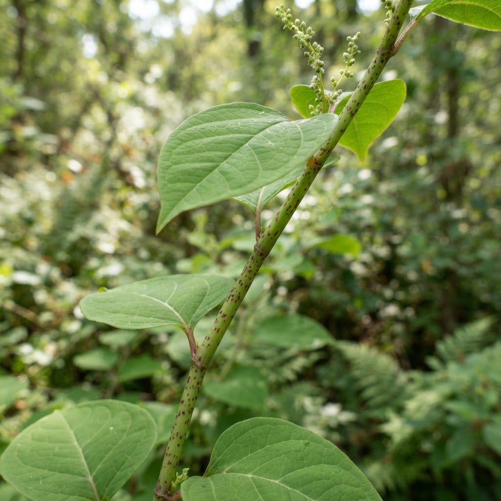
Japanese Knotweed
Reynoutria japonica
Bamboo-like stems, shield-shaped leaves, dense thickets along banks.
High RISK
Terrestrial / Riparian
Giant Knotweed
Reynoutria sachalinensis
Larger than Japanese Knotweed with very large leaves.
High RISK
Terrestrial / Riparian
Bohemian Knotweed
Reynoutria × bohemica
A hybrid of Japanese and Giant Knotweed.
 High RISK
Riparian
High RISK
Riparian
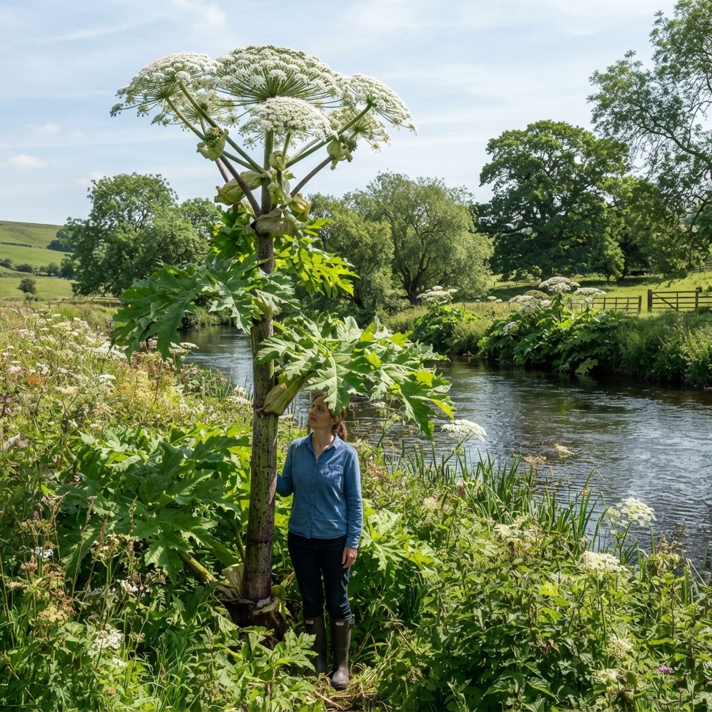
Giant Hogweed
Heracleum mantegazzianum
Tall plant with large white flower heads and toxic sap.
 Medium RISK
Riparian
Medium RISK
Riparian
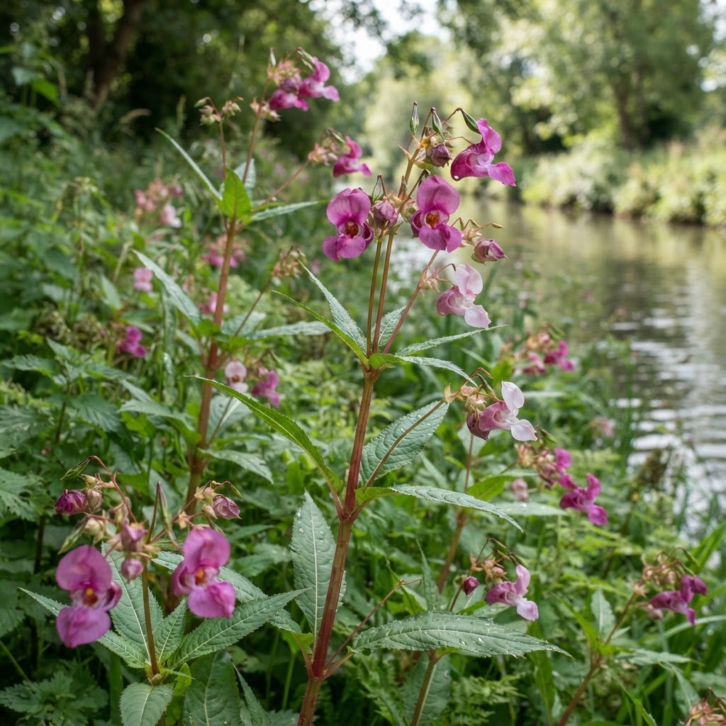
Himalayan Balsam
Impatiens glandulifera
Tall stems with pink-purple flowers; explosive seed pods.
 High RISK
Aquatic
High RISK
Aquatic
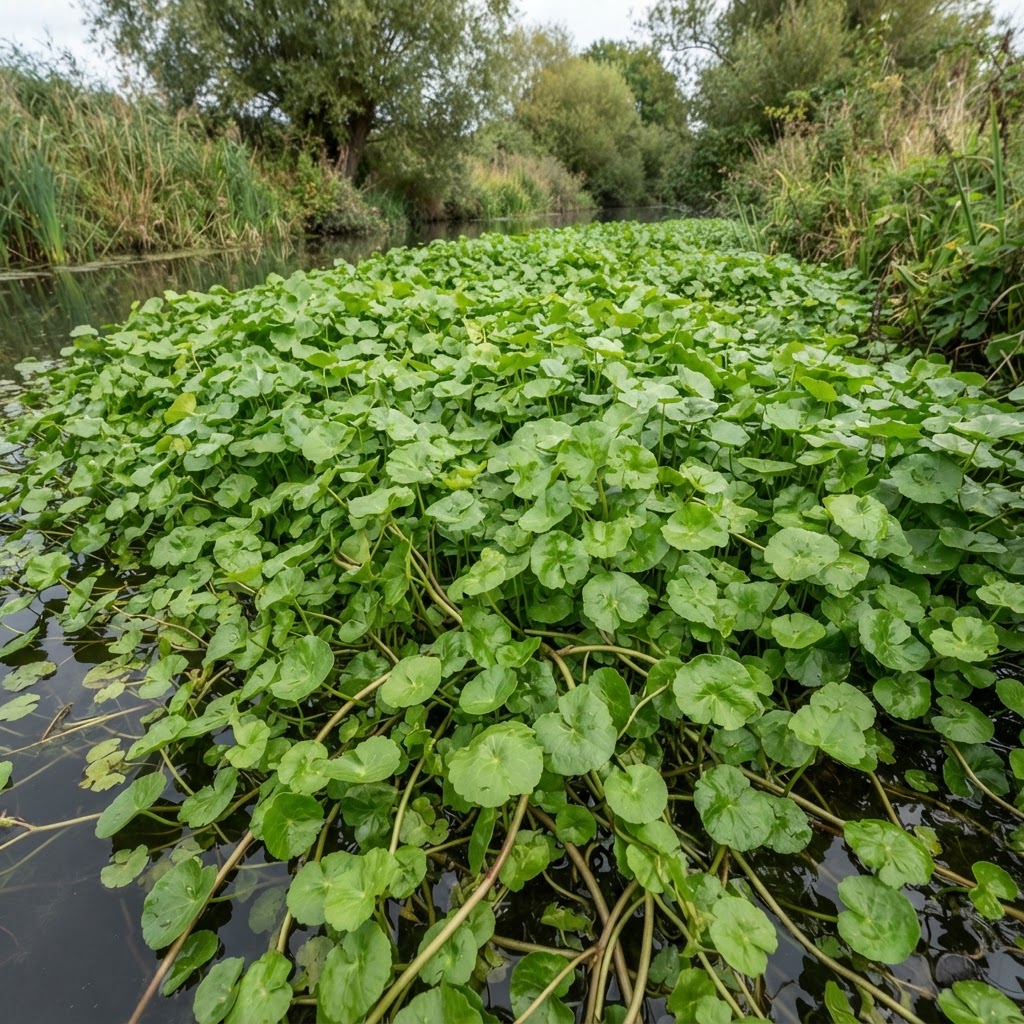
Floating Pennywort
Hydrocotyle ranunculoides
Mat-forming aquatic plant covering water surfaces.
Surveyors can also record other invasive or potentially problematic species encountered during a survey, building a broader picture of waterway biosecurity risk over time.
From Sightings To Environmental Intelligence
Finding an invasive plant is only the beginning.
Each JKWA survey record should be capable of building a much more detailed picture. Over time, individual records can become an evolving picture of invasive-species distribution, ownership, treatment and change across an entire waterway.
- Waterway
- River Irwell
- Species
- Japanese Knotweed
- Status
- Confirmed
- Bank
- East
- GPS
- Recorded
- Extent
- 18m
- Density
- High
- Photographs
- 6
- Previous record
- Yes
- 2026 status
- Active
- Ownership
- Under investigation
- Upstream reinfestation risk
- High
- Access
- Water / Land
- Treatment feasibility
- Suitable
- Priority
- HIGH
- Next action
- Stakeholder engagement
Making The Data Useful
Our ambition is not to collect environmental information simply for it to sit in a database. JKWA hopes to make appropriate survey intelligence available to organisations with a legitimate interest in Greater Manchester’s waterways — particularly those involved in their ownership, management, protection and improvement.
Different stakeholders may require different levels of information. The project should therefore be capable of supporting public environmental information alongside more detailed operational and management data where appropriate.
The JKWA Waterways survey will create a growing resource of current, location-specific invasive species intelligence. Relevant stakeholders will be able to access tailored data, mapping and survey information through JKWA on a commercial basis, providing valuable insight to support land management, environmental planning, treatment programmes and informed decision-making.
Finding The Problem Is Only The First Step
Once an infestation has been identified and the relevant stakeholders established, the next question is:
What are we going to do about it?
Thermo-Electric Treatment
Chemical-free specialist treatment may provide an option for appropriate Japanese Knotweed infestations, particularly where reducing herbicide use is desirable.
Precision Rhizome Excavation
For appropriate Japanese Knotweed sites, targeted excavation can be used to expose and physically reduce crown and rhizome material.
Specialist Vacuum Excavation
JKWA is also exploring specialist vacuum excavation as a method of controlled or precision excavation, particularly around buried services, infrastructure and restricted-access areas. Rather than automatically undertaking wholesale bulk excavation, vacuum excavation may allow affected ground to be progressively exposed while specialists identify and follow rhizome systems.
Vacuum excavation is presented as a developing trial methodology and is not marketed as an established JKWA eradication method.
Exploring Alternatives To Herbicide-Only Management
JKWA is particularly interested in developing practical management strategies capable of reducing reliance on conventional chemical treatment where site conditions allow. Our work includes the use and development of:
No single treatment method is appropriate for every infestation. The objective is to select and combine methods according to the site, species, environmental conditions and management objective.
Surveying Invasive Species Without Spreading Them
Biosecurity will be fundamental to every JKWA waterway survey. Equipment, footwear and the vessel itself can potentially become pathways for transferring plant fragments or other invasive organisms between waterways if not properly managed. JKWA survey routes and operating procedures will include defined biosecurity controls between water bodies.
CHECK
Inspect equipment, footwear and the vessel for plant fragments and organic material before leaving a site.
CLEAN
Clean and treat all equipment to remove visible soil and plant material.
DRAIN
Drain any residual water from equipment and the vessel to avoid transferring organisms between water bodies.
RECORD
Record biosecurity actions as part of the survey log for every waterway visited.
Greater Manchester Is The Pilot
Greater Manchester provides the opportunity to develop and prove the methodology across a complex network of urban rivers, canals, infrastructure, public land and private ownership. The pilot will allow JKWA to develop:
PROVE IT IN GREATER MANCHESTER.
BUILD A MODEL FOR THE UK.
A National Waterway INNS Intelligence Network
The longer-term ambition is to take what we learn in Greater Manchester and develop a repeatable survey and management model capable of deployment across other UK towns, cities, catchments and waterway networks.
Our ambition · our proposed model · capable of future rollout.
Project Tracker
The project is in active development. This tracker will grow with the programme as each phase is delivered.
Do You Have An Interest In Greater Manchester’s Waterways?
We would like to hear from organisations, landowners and professionals who own, manage, maintain, study or have responsibility for sections of Greater Manchester’s canals and rivers.
Seen An Invasive Species Along A Greater Manchester Waterway?
Tell us what you saw and where. Your report may feed directly into the Atlas verification workflow as the project develops.
We’re not simply mapping where invasive species are. We’re building the intelligence needed to understand where they are, who has an interest or responsibility, what action may be appropriate, and whether that action is working.